This week involved travelling through the city by foot, and observing the ever changing city – this including taking note and observing closely current projects such as HS2 and the development of Paradise Circus. What value does this add to the city? How do these fit into the wider context of Birmingham?
We were tasked with interpreting the city as though we were experiencing it for the first time, and began to think about the distinctive features that define Birmingham. One of the challenges for developing the brief for this project, is to determine what Birmingham’s identity is. Moving through the city it becomes clear how many physical changes are taking place, and the way in which people are interacting with various spaces is changing. The focus of the travel guide is to encapsulate some of these features that might otherwise be lost through the destructive redevelopment of the city.
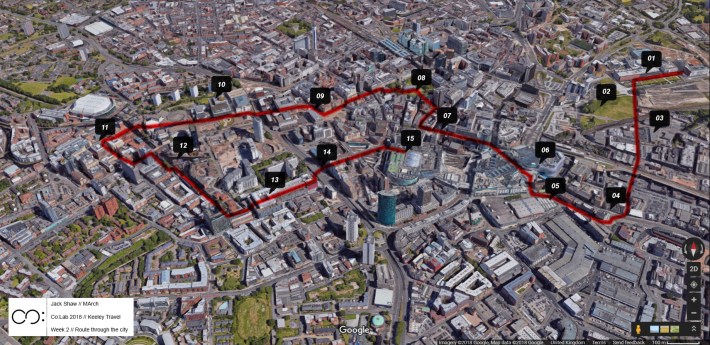
The key points on along the route, as follows, are marked on the map above:
01. Millennium Point
02. HS2 Development, Curzon Street station
03. The old Typhoo Tea factory
04. Digbeth High Street
05. Bull Ring Rag Market
06. The Bull Ring shopping centre
07. ‘The Ramp’ – a.k.a Stephenson Place
08. ‘Pigeon Park’ – a.k.a. St Philip’s Cathedral grounds
09. Town Hall
10. Library of Birmingham/ Paradise Circus
11. Brindley Place
12. Regency Wharf
13. The Mail Box
14. Queensway underpass
15. New Street Station/ Grand Central
Next week: we will discuss our findings our own interpretations as a group, and develop ideas about what elements of the city to encapsulate.
Jack Shaw

You must be logged in to post a comment.