The Connected Chelmsley unit group looks at studying the site of Chelmsley Wood, a post-war overspill housing estate to the east of Birmingham and is part of the Metropolitan Borough of Solihull.
Chelmsley Wood will be explored through mapping studies to explore the existing live and socio-spatial existing conditions within Chelmsley, which will be used as a tool for communicating the different issues which affect the estate.
The unit was divided into 3 topic groups, with the following work presenting studies from the Landscape, Topology & Topography group.
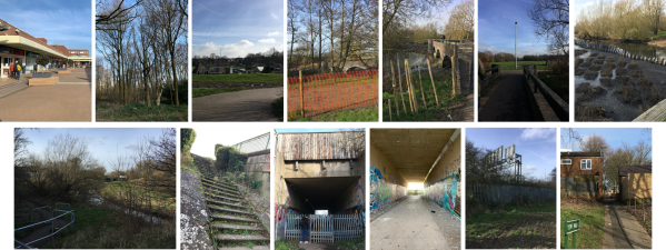
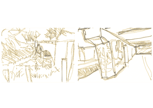
During the initial stages of the project, we visited Chelmsley Wood to better understand the conditions and to understand the estate on a more personal scale, documenting ideas and observations through sketches, note-taking and photographs.
Following the visit to site, we then created mapping layers to represent our experiential perspectives of Chelmsley, with each group member identifying different aspects of the estate which resonated with them, such as level changes and ground conditions, soundscape and levels of care. Despite visiting site and gaining a first-hand perspective of the estate, it was important for us to note that we were viewing it through an ‘outsider’ perspective, without experiencing how it was like to live in Chelmsley on a daily basis, which would affect our ability to fully record the living scale conditions.
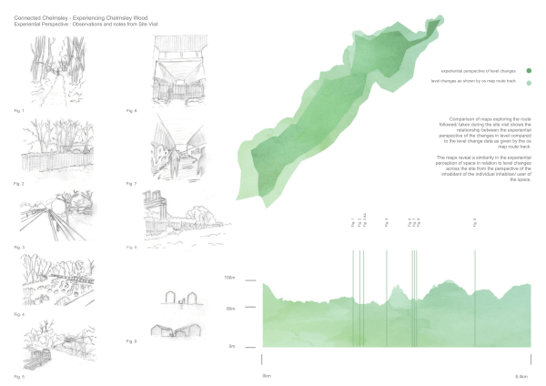
Level changes during the site visit were varied. The map, top right, explores the experiential perspective of the level changes throughout the journey and route taken during the site visit. The inner/ darker map shows the experience of level changes compared to the outer/ lighter map, which shows the actual level changes. The graph, below right, shows this level change information in a linear representation, with location markers corresponding to the sketches on the left to indicate the key locations visited, and where they sit on the graph.
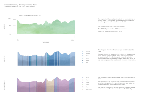
As well as the level changes being varied, the way and surface types were also. The blue graph shows way type and could serve to give an indication of circulation/ traffic, areas of more frequent use/ greater movement, and areas which could promote interaction/ social density. The purple graph shows surface type, looking at areas of ground treatment, which could give an indication of care or significance of locations around Chelmsley.

Site Sketches showing abandoned nature and vandalism distorting walls from graphite. Under bridges aren’t clean. When walking over the bridges, the ponds under aren’t taken care of, as nature isn’t looked after and preserved. Litter is left around onto the ground and dumped in bushes of plants. The colour in the lower images pick out the key conditions and social traces which create a sense of place.
The map above looks at the experience of the site, looking at soundscape in Chelmsley Wood.
A set of 3 Key terms were explored to focus the direction of our mapping studies, with mind mapping during the unit sessions being a useful tool in communicating our thoughts and ideas as a smaller topic group.
Our group collectively looked at the terms:
Morphology
Open Source
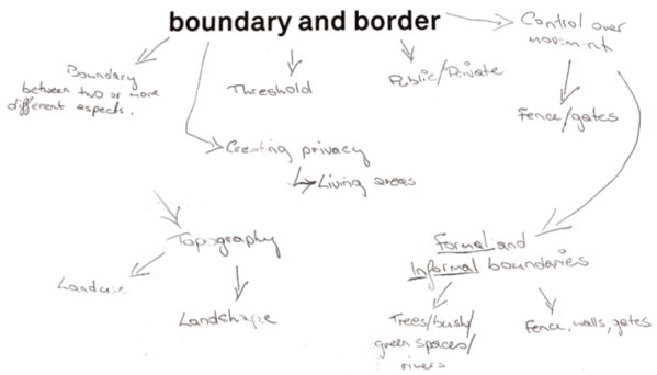
Boundary/ Border
With each of the different terms later being assigned to a group member to explore further, and to then share our findings as a group to discuss how to move the mapping studies forward. The Key Terms were a useful tool in helping us to identify the layers of mapping that we were to further develop in the following tasks.
Following the initial Key Terms mapping, we began to use Trello file sharing platform to share our work as well as to organize and structure our work and to monitor our progress on the project.
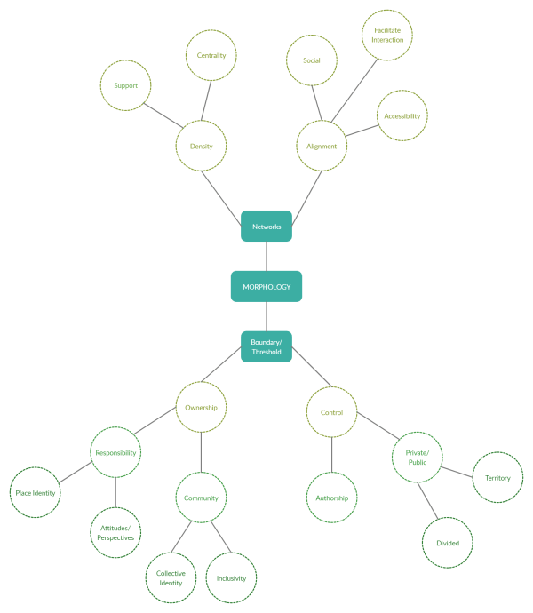

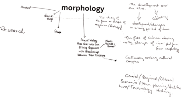
Understanding the term ‘morphology’:
1. Urban Morphology
This is studying the form of human settlements in an area, focussing on observing the process of their formation, transformation and evolution over time.
2. Spatial Morphology
This studies the patterns of space which are interconnected and are created and develop through the organisation of space, and which are differentiated through their surrounding context of physical and social boundaries.


–

You must be logged in to post a comment.